What Is a Watershed? How Rainfall Reaches Rivers in US and UK Landscapes
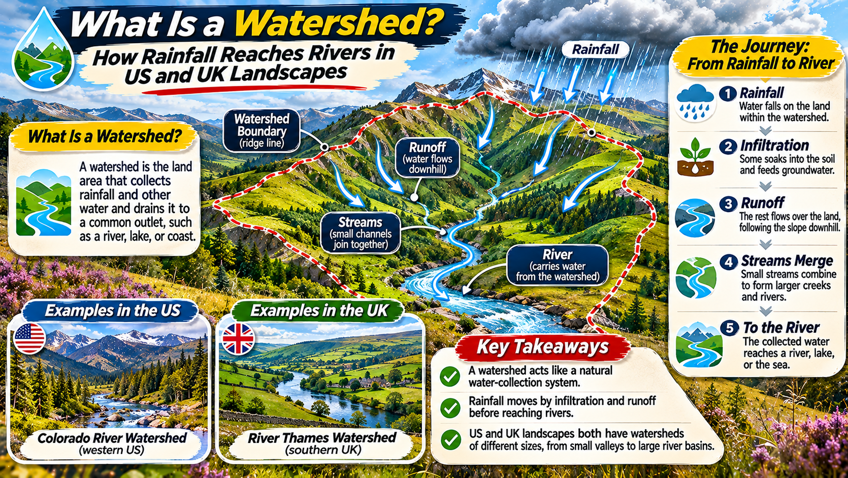
LANDSCAPE HYDROLOGY ATLAS ยท RIVERS & RAINFALL Following a Raindrop from Hillside to River Discover how watersheds collect and move rainfall, why drainage divides matter, and how rivers connect landscapes across the United States and United Kingdom. WATERSHEDS DRAINAGE BASINS RIVER SYSTEMS When rain falls on a hillside, where does the water go? Some of … Read more

How Waterfalls Retreat The Geology Behind Niagara Falls and High Force

EARTH SCIENCE FIELD NOTES / RIVERS & LANDFORMS How Moving Water Moves a Waterfall Explore the geology of waterfall retreat through two remarkable landscapes: Niagara Falls in North America and High Force in northern England. DIFFERENTIAL EROSION   /   UNDERCUTTING   /   GORGE FORMATION A waterfall can appear permanent. Its cliffs seem solid, … Read more

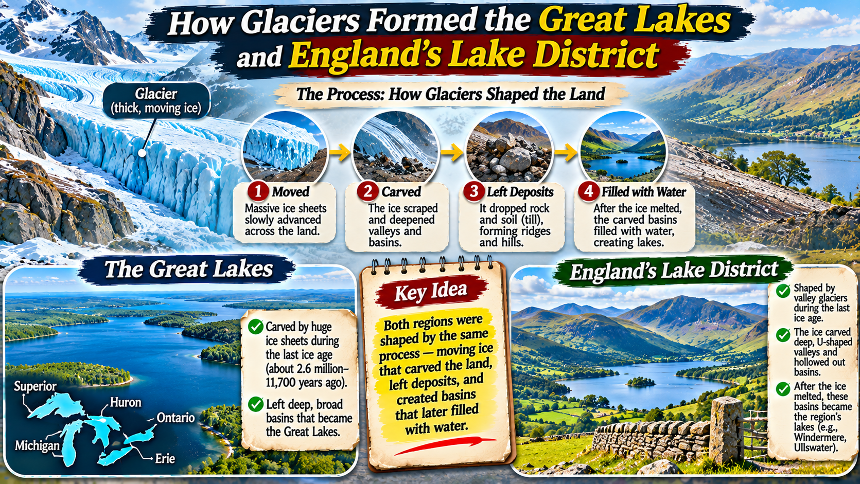
How Glaciers Formed the Great Lakes and Englandโ€™s Lake District

ICE AGE LANDSCAPE ATLAS ยท GLACIAL GEOLOGY How Moving Ice Carved Two Famous Lake Landscapes Discover how enormous ice sheets and mountain glaciers reshaped the land, deepened valleys, and left behind some of the world’s most recognizable lakes. GREAT LAKES LAKE DISTRICT ICE AGE GEOLOGY Some of the world’s most beautiful lake landscapes were shaped … Read more

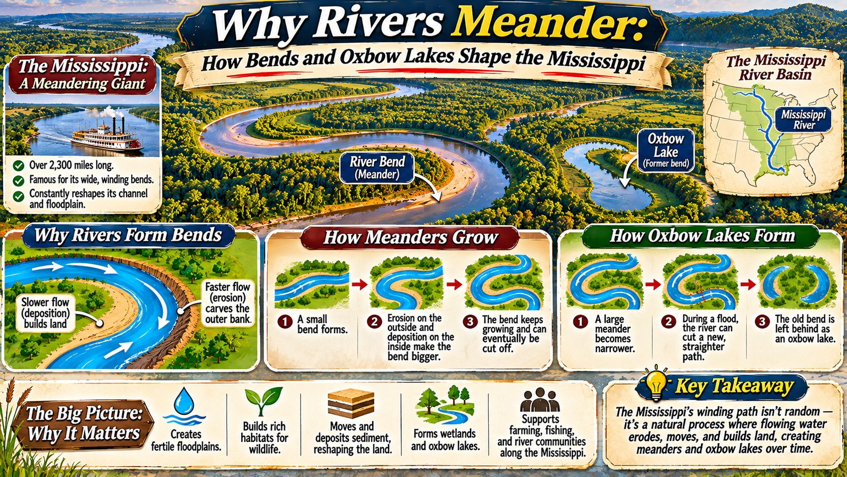
Why Rivers Meander How Bends and Oxbow Lakes Shape the Mississippi

RIVER GEOGRAPHY ATLAS / LANDFORMS & WATER SYSTEMS How a Winding River Reshapes the Land Around It Explore why rivers develop sweeping bends, how flowing water creates oxbow lakes, and why the Mississippi River is a remarkable example of a changing landscape. RIVER MEANDERS FLOODPLAINS OXBOW LAKES Look at an aerial photograph of the lower … Read more

Cryospheric Dynamics in the Water Cycle: Glacial Mass Balance, Snowpack Hydrology, and Permafrost Thaw Feedbacks

Monumental alpine glacier carved between jagged mountain peaks feeding liquid meltwater streams

1. The Cryosphere as Earth’s Master Freshwater Frozen Reservoir The cryosphereโ€”encompassing all portions of the Earth system where water is perennially or seasonally frozen in the form of continental ice sheets, ice caps, alpine glaciers, seasonal snowpack, sea ice, lake ice, and subterranean permafrostโ€”constitutes the ultimate physical storage buffer in the global hydrological cycle. Holding … Read more

Evapotranspiration Mechanics: Penman-Monteith Modeling, Stomatal Conductance, and Latent Heat Energy Fluxes

Sunlit agricultural field and dense forest canopy releasing water vapor through evapotranspiration

1. Biophysical Architecture of Terrestrial Evapotranspiration Evapotranspiration (ET) represents the coupled biophysical process whereby liquid water is transferred from the terrestrial surface into the atmosphere as water vapor. Operating at the critical interface of the soil-plant-atmosphere continuum (SPAC), evapotranspiration combines two distinct physical pathways: evaporationโ€”the purely physical vaporization of water from bare soil surfaces, wet … Read more

Precipitation Physics, Cloud Microphysics, and Orographic Lifting: Droplet Nucleation and Storm Dynamics

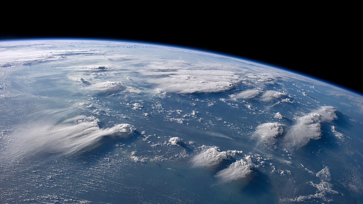
Towering cumulonimbus storm cloud illustrating convective updrafts and precipitation nucleation

1. Atmospheric Thermodynamics and Adiabatic Cloud Genesis Precipitation represents the primary delivery mechanism replenishing all terrestrial freshwater systems on Earth. The journey of water from an invisible, dispersed atmospheric gas to liquid raindrops or solid snowflakes is governed by rigorous thermodynamic transformations occurring within ascending, cooling air parcels. The genesis of all convective, frontal, and … Read more

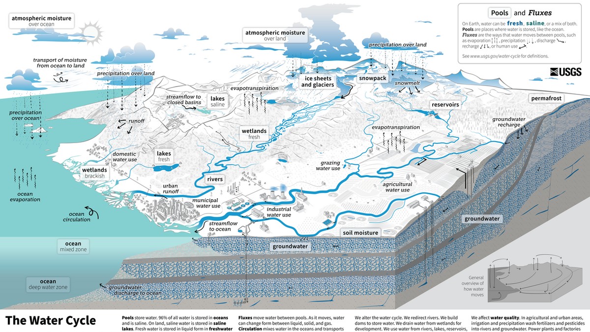
The Global Hydrological Cycle: Quantitative Fluxes, Atmospheric Moisture Transport, and Terrestrial Water Budgets

Scientific diagram of the global water cycle illustrating evaporation, precipitation, and runoff

1. Planetary Thermomechanics of the Global Water Cycle The global hydrological cycle represents the most immense physical mass-transport and thermodynamic energy-distribution engine operating within the Earth system. Driven ceaselessly by incident solar irradiance and modulated by planetary gravitation, the cycle continuously circulates water through its vapor, liquid, and solid phases across the atmosphere, oceans, terrestrial … Read more

Integrated Watershed Management and Non-Point Source Pollution: Soil Erosion Control, SWAT Modeling, and Catchment Policy

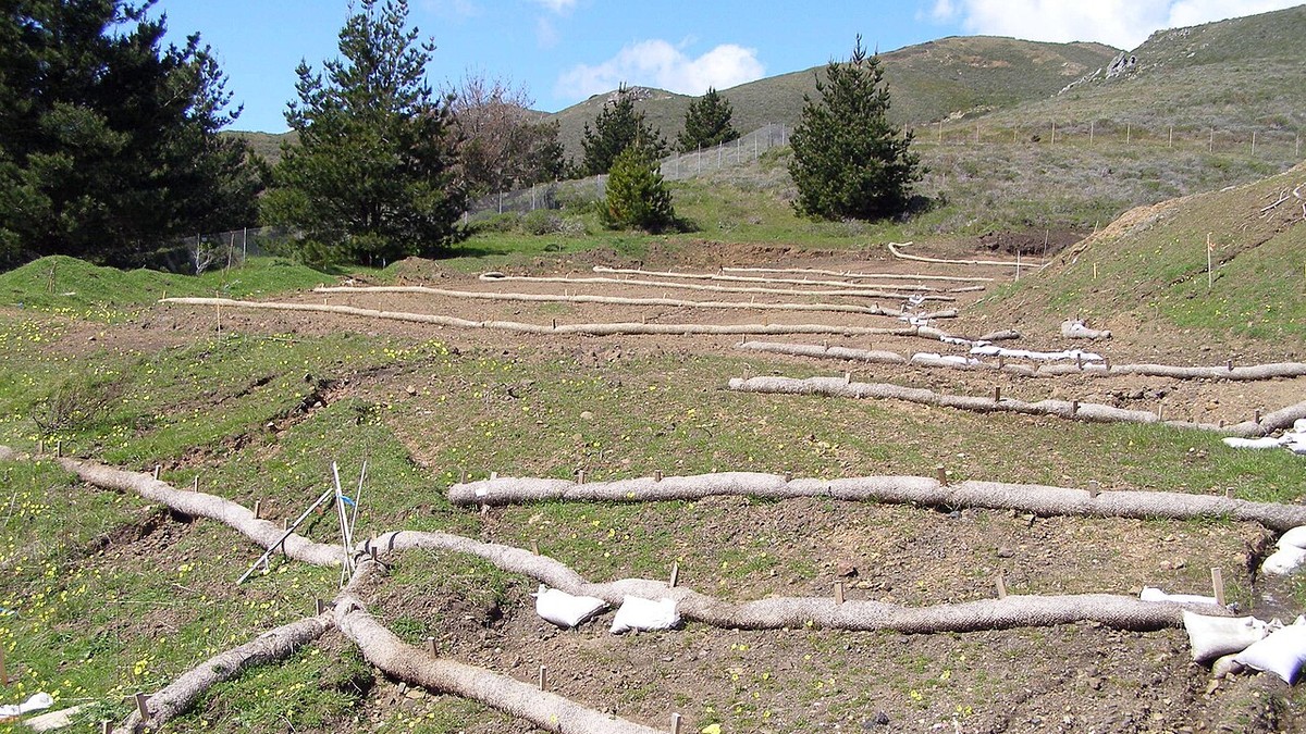
Agricultural hillslope managed with contour farming terraces and vegetative buffer strips

1. The Paradigm of Integrated Watershed Management (IWM) Integrated Watershed Management (IWM) represents a comprehensive, multi-disciplinary paradigm that coordinates the conservation, management, and sustainable development of land, water, and biological resources within the natural geographic boundaries of a drainage basin. Historically, natural resource governance suffered from severe administrative fragmentation: agricultural agencies focused exclusively on crop … Read more

Catchment Hydrology and Watershed Delineation: Topographic Divides, Strahler Stream Order, and Drainage Network Geometry

Satellite composite showing extensive river drainage basin topography and dendritic stream networks

1. Foundational Architecture of Watersheds: Topographic and Phreatic Divides A watershedโ€”interchangeably termed a catchment basin, drainage area, or river basinโ€”constitutes the fundamental, irreducible landscape unit of terrestrial hydrology, geomorphology, and ecological governance. By definition, a watershed encompasses the entire terrestrial surface area from which all impinging meteoric precipitation, surface runoff, and sub-surface baseflow converge topographically … Read more