What Is a Watershed? How Rainfall Reaches Rivers in US and UK Landscapes
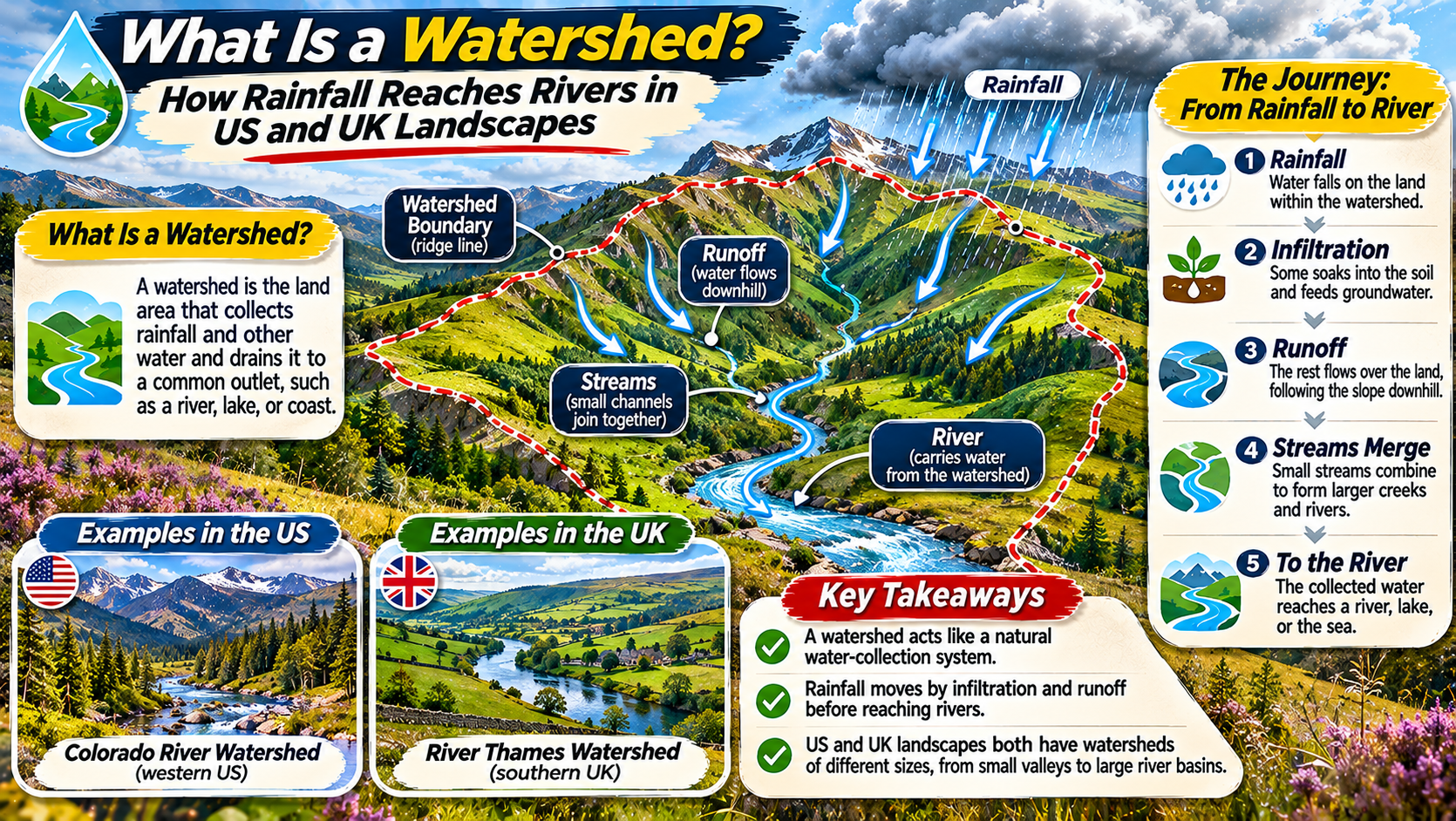
LANDSCAPE HYDROLOGY ATLAS ยท RIVERS & RAINFALL Following a Raindrop from Hillside to River Discover how watersheds collect and move rainfall, why drainage divides matter, and how rivers connect landscapes across the United States and United Kingdom. WATERSHEDS DRAINAGE BASINS RIVER SYSTEMS When rain falls on a hillside, where does the water go? Some of … Read more
Integrated Watershed Management and Non-Point Source Pollution: Soil Erosion Control, SWAT Modeling, and Catchment Policy

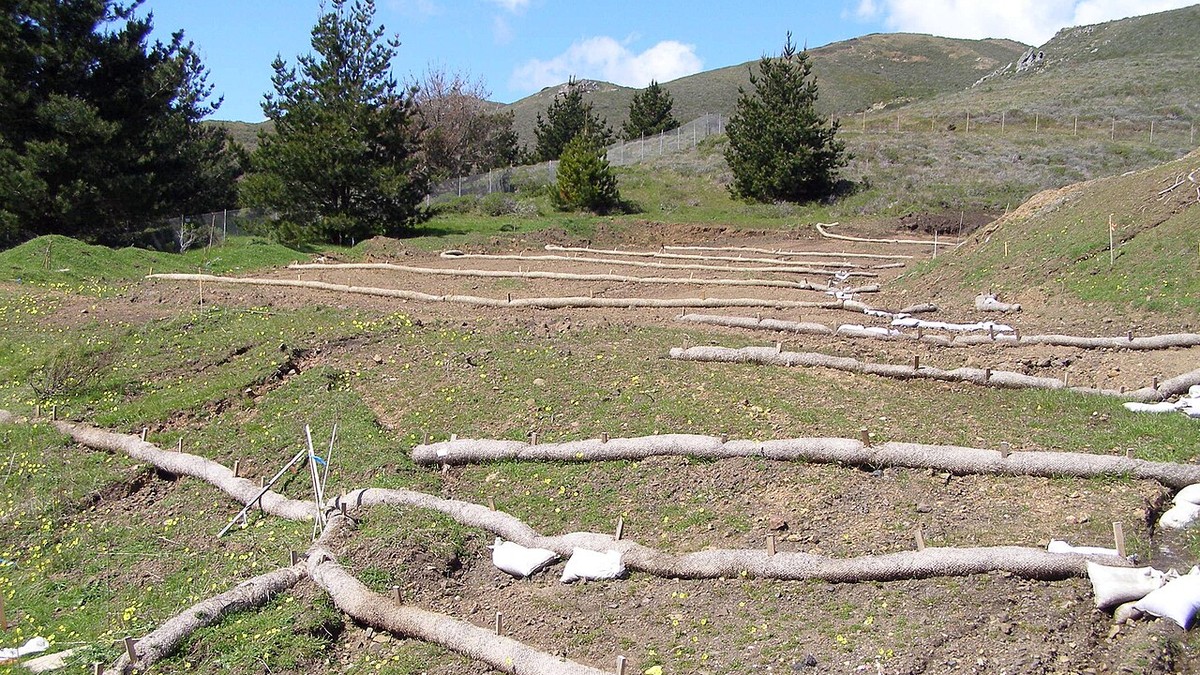
Agricultural hillslope managed with contour farming terraces and vegetative buffer strips

1. The Paradigm of Integrated Watershed Management (IWM) Integrated Watershed Management (IWM) represents a comprehensive, multi-disciplinary paradigm that coordinates the conservation, management, and sustainable development of land, water, and biological resources within the natural geographic boundaries of a drainage basin. Historically, natural resource governance suffered from severe administrative fragmentation: agricultural agencies focused exclusively on crop … Read more

Catchment Hydrology and Watershed Delineation: Topographic Divides, Strahler Stream Order, and Drainage Network Geometry

Satellite composite showing extensive river drainage basin topography and dendritic stream networks

1. Foundational Architecture of Watersheds: Topographic and Phreatic Divides A watershedโ€”interchangeably termed a catchment basin, drainage area, or river basinโ€”constitutes the fundamental, irreducible landscape unit of terrestrial hydrology, geomorphology, and ecological governance. By definition, a watershed encompasses the entire terrestrial surface area from which all impinging meteoric precipitation, surface runoff, and sub-surface baseflow converge topographically … Read more

Infiltration Mechanics, Groundwater Recharge, and Subsurface Hydrology: Darcy’s Law and Baseflow Dynamics

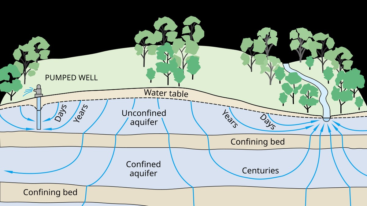
Cross-section diagram of groundwater aquifer strata, water table, and artesian recharge zones

1. The Soil-Water Interface: Infiltration Physics and Unsaturated Zone Mechanics The terrestrial water cycle hinges upon a fundamental physical partition that occurs at the very surface of the Earth: the separation of incoming meteoric precipitation into surface overland flow and subsurface soil infiltration. The capacity of a landscape to absorb water governs flood frequency, agricultural … Read more

Wetland Hydrology, Riparian Buffers, and Floodplain Dynamics: Nutrient Assimilation and Flood Hydrograph Attenuation

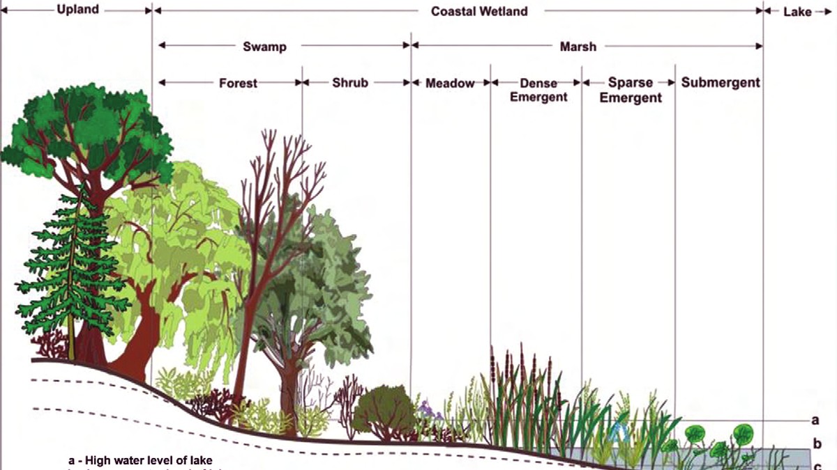
Expansive freshwater wetland marsh with emergent vegetation and shallow meandering channels

1. Wetland Hydrology as the Primary Ecological Driver Wetlands occupy the dynamic ecotone between purely terrestrial and permanently aquatic ecosystems. Far from being marginal wastelands, wetlands are among the most biologically productive, biogeochemically active, and hydrologically indispensable landscapes on planet Earth. The singular, non-negotiable master variable dictating the genesis, physical structure, and ecological persistence of … Read more